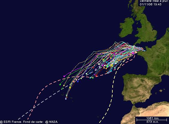
Chart as of 19:45 on 1st November:
Wind forecast for 6Z on 2-11-2006:
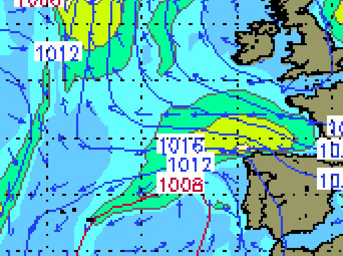 So it looks like increasing easterlies for the fleet up to 30 - 35 knots. The multi-hulls way ahead of the main pack can be seen to be heading south to get those winds just to the north of that mini-low.
More on this later - till then, anyone know a better approach? I see there is a RdR Google Earth link, but it seems to be less up to date than the web site charting tool.
Also does anyone know of any GRIB files in Google Earth format?
Cheers
Graphics from www.stormsurfing.com and www.routedurhum.org
No comments:
Post a Comment