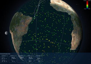
You can see why in the weather chart from Virtual Spectator figure below.

The South Atlantic high, that often resides close to the island of St. Helena, drives the winds hard on the nose of any boat that would try the direct path. So it's faster to head south till its time to turn to port. But when? thats will be the next question for navigators to ponder over, when to turn?
But that decision is not yet, as for the next few days they'll be following the same track one after the other with few opportunities to pass. Pure boat speed will drive which boat comes 2nd, 3rd and 4th. But not 1st, where ABN-1 has a clear 80 miles over Ericsson.
No comments:
Post a Comment