Saturday, July 31, 2021

Lea Valley Walk 6: The Greenway


The Lea Valley walk crossed the Greenway on multiple occasions so it seemed a good idea to complete the walks in this part of London by including it.

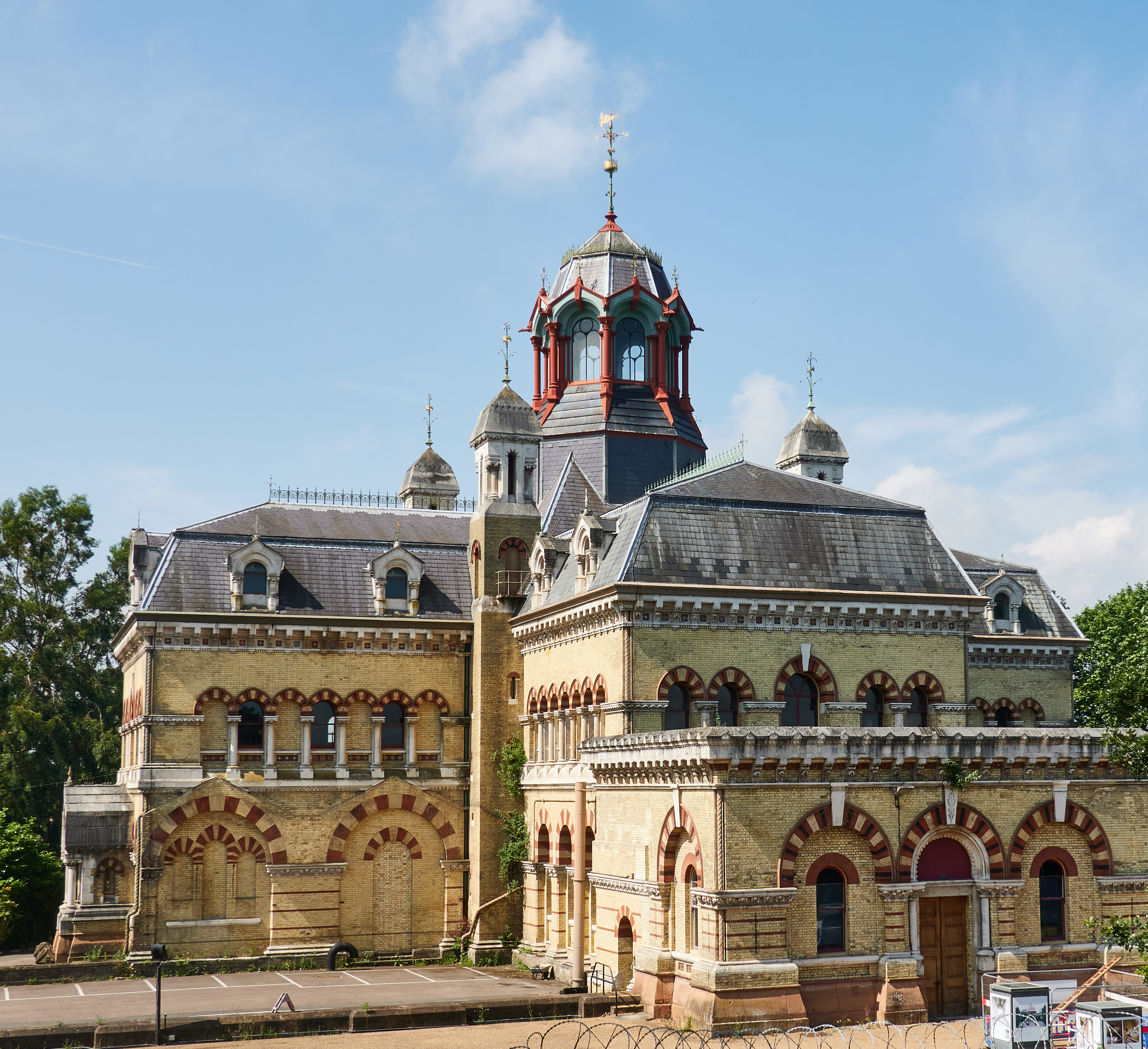
I've encountered the Greenway before the Lea Valley walks, in particular on leaving the Olympic Stadium after the amazing Paralympics Closing Ceremony and later to get to / from the Abbey Mills pumping station when exploring Bazalgette's sewage system, as blogged here.

The close proximity of the Greenway with the Abbey Mills pumping station is not a coincidence. The old name for this route was the Sewerbank, as it basically is build on top of huge sewers taking waste down to the Beckton Sewage works. As well as Bazalgette's sewers, underneath that there's the new Lee Tunnel, part of the Thames Tideway project.

Must admit I found it a bit boring, as most of the time it was an almost dead straight line, like those roads in the desert, but rather than dramatic desert scenery there were housing and industrial estates on either side.

At one point there was an observation point, and I wondered what vista I would see, for apparently Gandhi when he came to London used to walk the Sewerbank and he "enjoyed the elevated view the bank offered". 

But in this case the view turned out to be another industrial estate - plus of course the path itself:

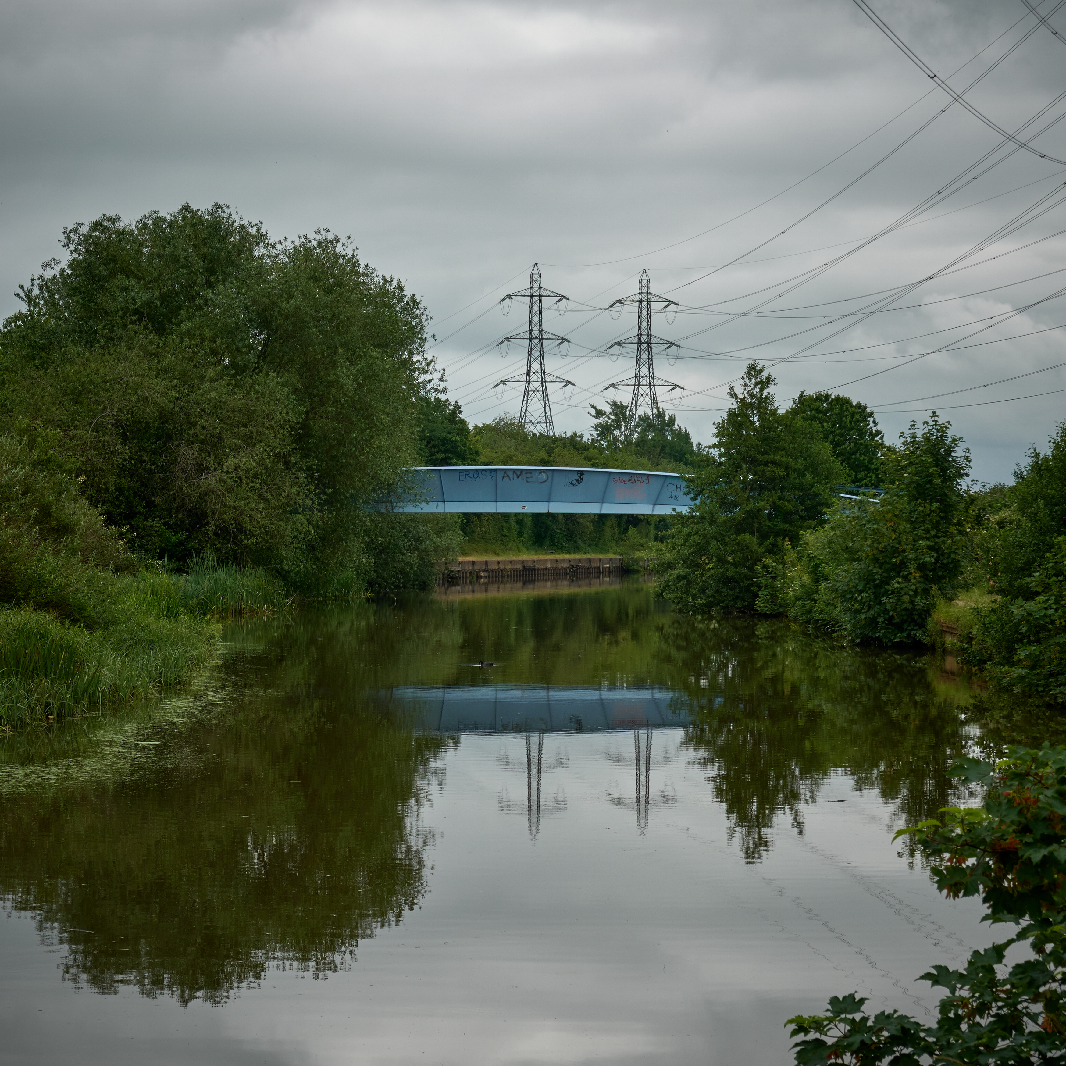
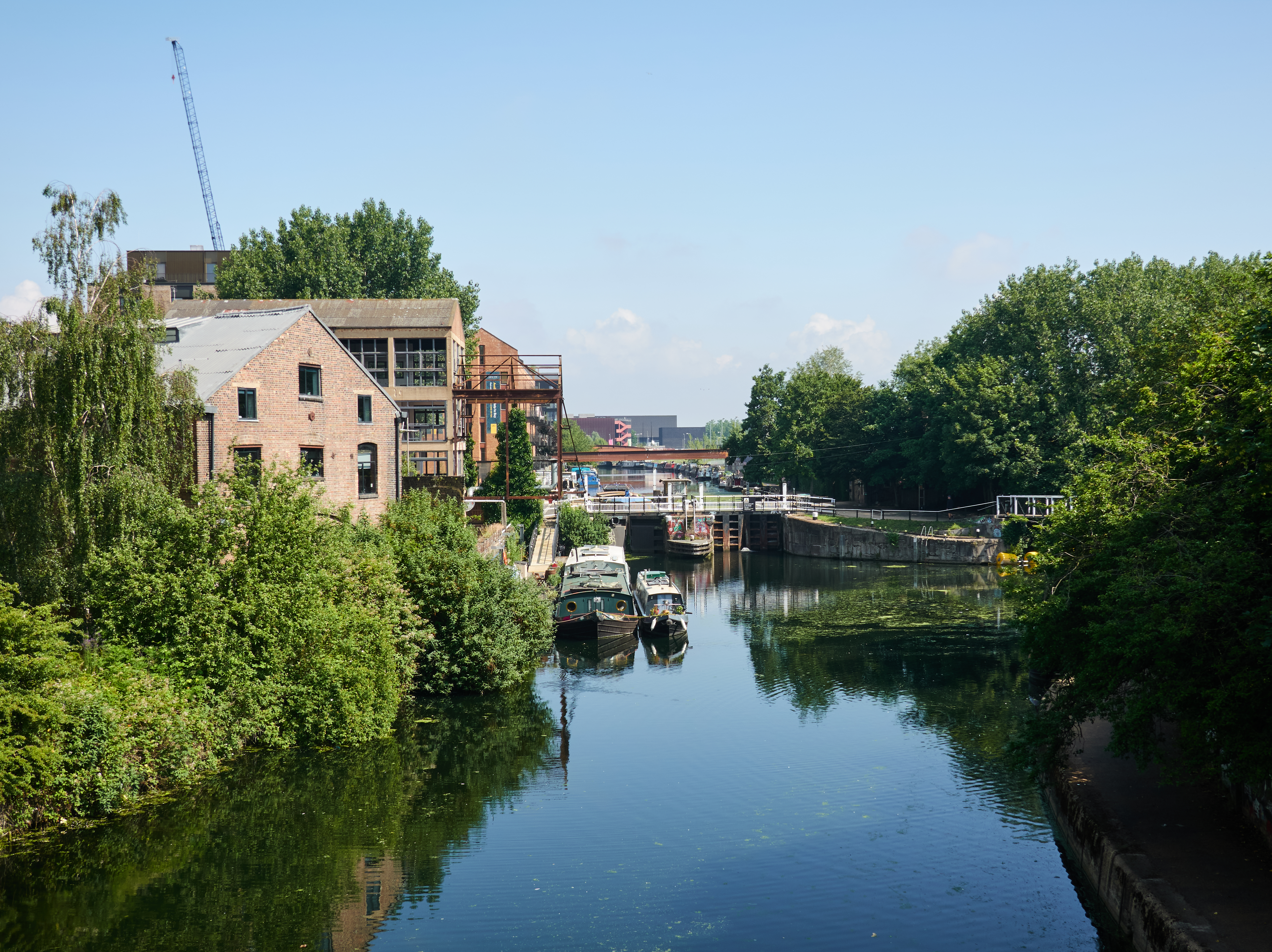
High spots were mostly at the start, including an old pillbox, the  Lee Navigation and the Abbey Mills pumping station:


The original plan had been to end at either Beckton or Gallions Reach DLR stations, but the route had been so boring that I decided to extend it to Woolwich North and take a ferry then Thames Clipper for the scenic route home...

The keen eyed might spot that the structure above was blogged about previously during the Erith to Greenwich walk back in 2014 when Boris was London's Mayor.


Thursday, July 29, 2021

Lea Valley Walk 5: Electricity Stations and Pylons


 As mentioned in the previous post, the Meridian Water to Waltham Cross section of the Lea Valley walk had a lot of electricity pylons, which reflected nicely in the still water.

The water was disturbed by travelling canal boats, but it turned out I walked faster than them, so I just had to keep going at a brisk pace until I was out in front to get nice reflections.


Monday, July 26, 2021

Lea Valley Walk 5: Meridian Water to Waltham Cross


This segment of the Lea Valley walk finally took me beyond that great dividing wall which is London's orbital motorway, the M25, as seen above in the distance.

It was a moody, cloudy day that I returned to Meridian Water for this week's 11.7 km hike:

TBH, not sure that Meridian Water is the best place to split the journey as Tottenham Hale has a lot better transport (e.g. the Victoria Line). But I ended there last time and it meant could do the final stretch in one go. 

This time avoided the North Circular nightmare and went the back route, but even it wasn't that pretty. For example, this functional ditch is meant to be a "brook":

Anyhow, crossed via a bridge over to the tow path and headed north along the Lee Navigation.

It was the day of the Lea Valley 50k, so there was a steady stream of runners heading south. As the morning went by it was noticeable how more and more were walking rather than running. There were also cyclists heading in both directions:

The scenery was a bit industrial, with warehouses on one side of the Lee Navigation and boats on the other:

There were also power plants and long lines of electricity pylons followed the Lee Navigation, so many I've saved them for another post.

On one side, hidden from view, were London's vast water reservoirs, and they did seem to attract wildlife, for often the main sounds were bird song and the crawk of the heron:

Finally, traffic noise could be heard ahead, and the Lee Navigation went under the M25:

I decided to call it a day at Waltham Cross and decided to head for the best restaurant I could find for lunch, which turned out to be KFC.

After a finger licking meal, I made my way to the railways station, which still within the remit of London Transport so could just tap to enter, and made my way home.


Saturday, July 24, 2021

Lea Valley Walk 4: The Hackney Flotilla


As mentioned previously, when walking along the Lee Navigation I couldn't help but notice a protest was being arranged later that day by the narrowboat community. They were concerned about a potential reduction in the numbers of moorings, as described in this article.

In addition to the banners there was a steady stream of boats heading towards Hackney to take part, such as these two:


Note the impressive hat of the woman helming the one above:


However I didn't stick around as I'm not sure I actually agree with their position, and the biggest problem was this:


I set out to walk the Lea Valley, the Lea River and the Lee Navigation, but most of the time I was walking between a long, long line of narrowboats and bushes. It was only rarely that there was a view of the river.

And all too often the boats were a bit like junkyards or trailer parks:


Yes, there needs balance, but at the moment it feels like nearly 100% of the Lea Valley walk is actually cut off from the water.

It felt a bit like those bits of the Thames Path where posh developments have demanded exclusive access to the river and the path is pushed back into industrial estates. 

The compromise that is used along most of the Thames Path is that, yes, there can be developments along the river but they must allow the public also to enjoy the river and walk directly next to it.

The canal system of Britain is a National Treasure, something we all should be able to enjoy. It is there for boats to travel along and should not be utilized as one long parking lot.

So a thinning of the boats would bring benefits. It would also help other water users, such as rowers, kayakers and canoers.

Maybe additional narrowboat marinas are needed, such as this one on the right of this photo:

Maybe one of the large unused docks could be transformed - such as the Royal Victoria or Royal Albert Docks where the Lea meets the Thames?

Thursday, July 22, 2021

Lea Valley Walk 4: Clapton Pond to Meridian Water


One very hot Sunday, I took a combination of train, tube and bus to Clapton Pond to continue the walk north along the Lea Valley beside the Lee Navigation.

There were a number of possible end points to choose from, so I basically kept going until it felt like enough and then headed to the nearest train station, which turned out to be Meridian Water. In total it was probably about 9 km.

This stretch of the Lea Valley was all navigable, and so there were a lot of narrow boats, but they were not at all happy. It was the day of the Hackney Flotilla to protest about changes to mooring policy, and there was a lot of signs about this:

I could have waited and watched the flotilla but didn't, and not just because it was a scorchio weather, but I'll leave that to another post.

This part of the tow path is basically a long line of narrow boats on one side and then the wetlands on another. The Walthamstow Wetlands are a nature reserve that doubles up as water reservoirs for London (though to be honest, it's probably the other way round).


Towards the top end the long line of narrow boats thinned out and it was possible to see a bit more of the landscape, which sometimes was picturesque and sometimes rather industrial.


This might look like a boring industrial building but is actually the hot music venue Drumsheds:

There are a couple of groups playing there that I'd be interested in seeing but it's way too far out (and not in a good way), so I'm not going.

At the end I headed off (as I said) to the Meridian Water train station, and the road I used to get there was a bit of shock:

I really do not recommend this route - which effectively meant walking alongside the North Circular (Londoners will know what this is). I think there was a better crossing point half a mile or so down the Lee Navigation with path to the station - though it looks like it goes though an industrial estate.

After much fighting my way across road systems actively hostile to pedestrians (and god help any poor cyclist), I arrived at the Meridian Water train station, which I think is London's newest:

In fact it is so new that it doesn't appear on the Google Earth map at the top, which marks the old station which was just up the tracks, namely Angel Road. 

The All The Stations team of Geoff and Vicky went to the opening of Meridian Water, and you can watch their video of that visit here. Geoff also made a video (here) of his visit to the old Angel Road before it was closed and it's fair to say he wasn't impressed. Words used to describe it include grim, austere, destroying dark, dejected, dreary, drab, sullen, sombre, sad, depressive, oppressive....

The reason for this brand new station is not current demand - for there was only a couple of other people on the train - but a huge planned development called, unsurprisingly, Meridian Water, which has its own web site, here.

A shuttle train goes from Meridian Water down to Stratford every 30 minute so, and from Stratford train and tube lines run in all directions.

Tuesday, July 20, 2021

Lea Valley Walk 3: Three Battles over Water


There's a lot of history behind the Lea Valley, for its river brings all sorts of opportunities to many different types of user. But they can't all be satisfied at the same time, which leads to conflict, of which these are just three.

1. Navigation vs. Power 

At the top of Hackney Marshes, where now the Lea River and Lee Navigation part, there used to be water mills. These were used to all sorts of tasks, from grinding corn, to boring tree trunks to even grinding the points to pins and needles (see history panel above).

These water mills needed water (obviously) so the millers wanted to control the water flow. But that caused problems for the bargemen who had different needs. The millers sometimes abused their power, deliberately lowering water levels so barges were grounded.

The solution was the Hackney Cut, so each could keep using the Lea, the mills grinding corn and the barges transporting it down river. That split continues to this day, with the Lea River and Lee Navigation.

2. Narrow Boat Owners vs. Water Safety Zones

This one is more recent - in fact it is still ongoing. All along the Lee Navigation were these banners and fly posters:

So what were they all about?

I had a search and came up with this story about a protest against "water safety zones". Apparently the Canal and River Trust (CRT) are concerned about "very high or competing waterway uses" and want to put in additional signage and restrictions in parts of the Lee Navigation such as in Hackney.

But boat owners say it could displace boat to move elsewhere.

This is not a new problem: boat numbers in London have been rising and putting a strain on 200 year old canals and resources. See this post from the CRT and this from the National Association of Boat Owners.

The wider picture is the high price of living in London which makes the low costs of narrow boats seem attractive. Of course the reality of boat life can be pretty tough, with sometimes basic facilities and lack of permanent moorings means a constant need to move on.

It's also the case that this overcrowding can make the canals and navigations a bit of a mess. I much preferred walking down the Lea River to the Lee Navigation as the latter was basically a long boat park. And many boats were pretty tatty - it felt at times like a cross between a trailer park and a scrap yard.

There must be some sort of compromise as the current situation seems unsustainable. Maybe placing tighter limits on number of boats in exchange for better facilities?

3. Water Companies vs. the Environment

The day I walked this bit of the Lea River was a bit of a scorchio and so locals had headed into the waters to cool off:

This might look fun but is actually rather risky, as all along the Lea River were signs like this:

I don't get this. 

Hackney Council admits the Lea River is "very polluted water" and its response is not to clean up the river but to put up signs against swimming.

This is just bonkers but alas is part of a trend. Last year, water companies discharged raw sewage into English rivers more than 400,000 times!!

Look at the yuck left on the trees:

There are only a small number of chalk streams worldwide and 80% are them are in England - they are a natural resource to be protected and the water companies first extract clean water from them and then discharge raw sewage into them.

This is a disgrace!!

If you want to find out more about this issue, follow campaigner and ex-Undertones singer Feargal Sharkey on Twitter.

Saturday, July 17, 2021

Lea Valley Walk 3: Hackney Marsh Loop


Bank Holidays in the UK are traditionally times for the weather to turn cold and wet, but this one was to be an exception. The last Monday in May, which was when I did this walk, was, like today, properly scorchio, and I used it to do another Lea Valley walk, this time a loop around the Hackney Marshes.

The route is shown above:

  • Get the tube to Stratford
  • Start at the ex-Olympic Stadium
  • Head up the Lee Navigation (the red line to the left i.e. west)
  • Head down the Lea River (the red line to the right i.e. east)
  • End at the ex-Olympic Stadium
  • Get the tube home from Stratford

This ended up as a loop around Hackney Marshes, which you might image are actually marshes but are really football fields, lots of them, with up to a hundred games being played there at weekends. Though when I was there it was a lot quieter:

In total it was about 11 km in total.


It was a good walk.

Top tip: the Lea River portion has two paths: the official one (tarmacked) and another closer to the river between the bushes and under trees, which is much nicer:

There were a number of differences between the Lee Navigation and Lea River which I'll leave for another post, the result of battles over the years which are still continuing.

Thursday, July 15, 2021

Lea Valley Walk 2: Three Mills and the Olympic Park photos

Urban post-industrial landscapes under moody skies.


Abbey Mills pumping station and a pump.

Short parts of the walk (along Abbey Creek) felt surprisingly rural:


Hmmmm.... no actual photos of either Abbey Mills or the Olympic Park here. Oh well, you get the idea, they are photos from that part of the walk.