 Good luck and safe sailing for all boats and crew currently heading out of Wellington taking the long road to Rio across the southern Pacific. The longest leg of the Volvo Ocean race has started with all boats pointing their noses south to south-east.
While checking out the final crew list (which can be found here) I noticed something interesting - half the navigators are Brits. Ok, its only a small sample of six now Brunel has decided to sit out the legs between Melbourne and New York. But is it a fluke or an indicator? Does Britain's wider view of the world (say compared to Americans) give a greater feel for geography? Does the famous British weather and Brit's interest in the weather develop an intuitive feel for highs, lows and fronts?
Anyhow, being another Brit with an interest in navigation, a quick look ahead, graphics from www.stormsurfing.com. The wind and pressure for the next 24 hours and 48 can be seen below. As a rough estimate if the boats do 420 - 480 miles in 24 hours they will cover about 7 - 8 degrees of latitude.

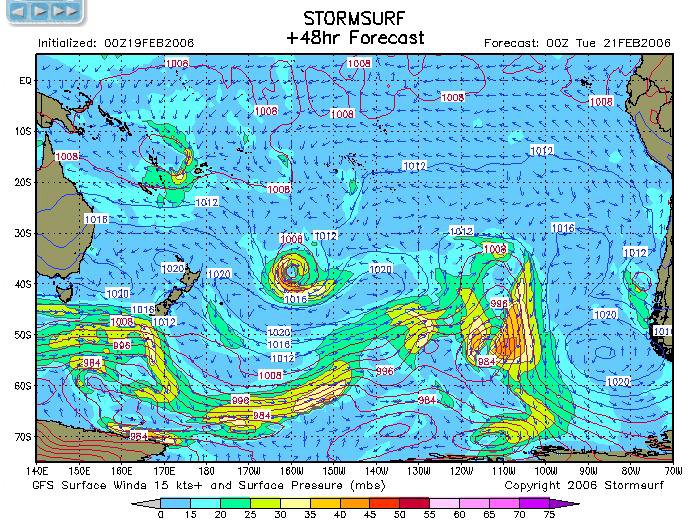 A big low can be seen to the north east (at around 35S, 160W) squeezing a high below it. There's currently good wind at 50S, 170W but by the time they get there it will probably fade out, leaving lighter winds. Thats not good news for Moose and Black Betty, but maybe a ray of light for Neil & co on Ericsson.
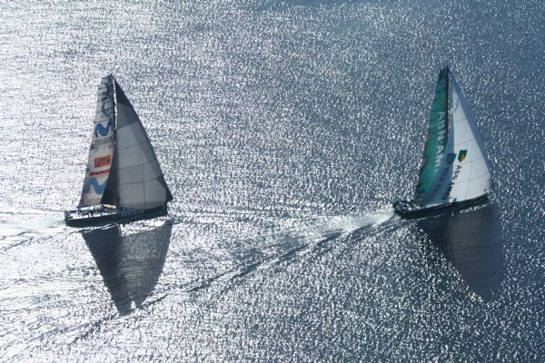
By the way, the pretty picture at the top comes from http://team.abnamro.com/ and shows the end of leg 3.
No comments:
Post a Comment